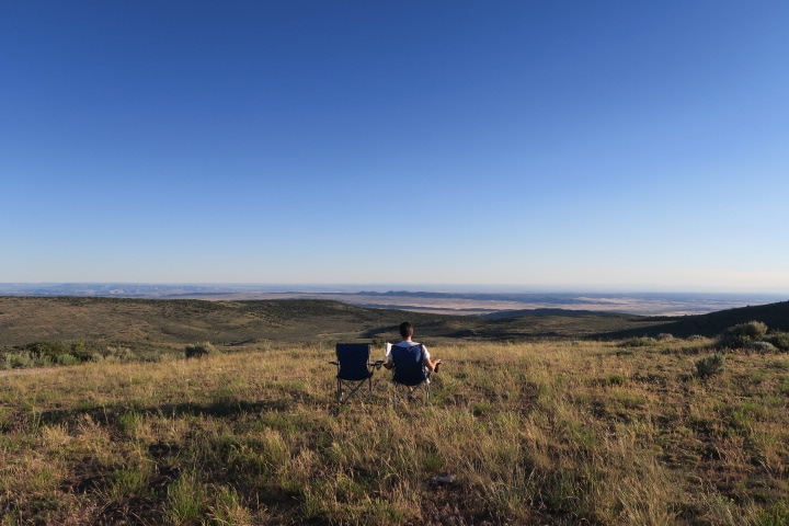
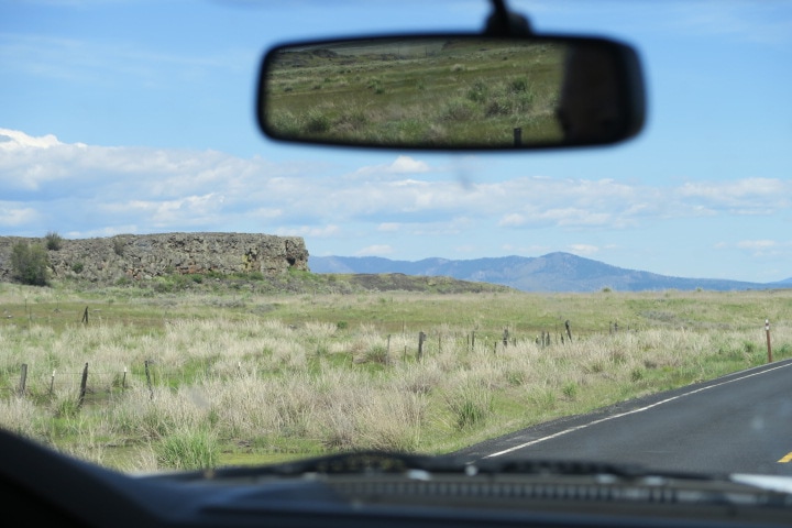
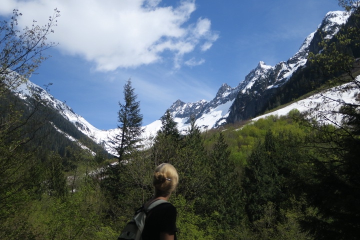
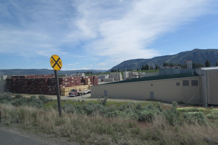
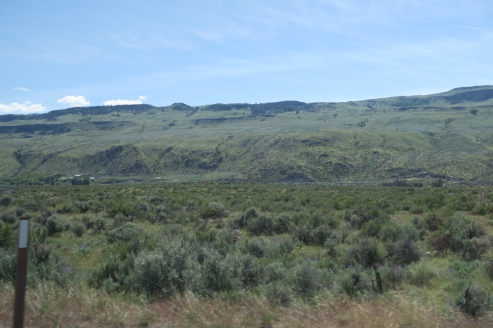
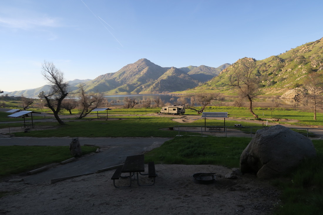
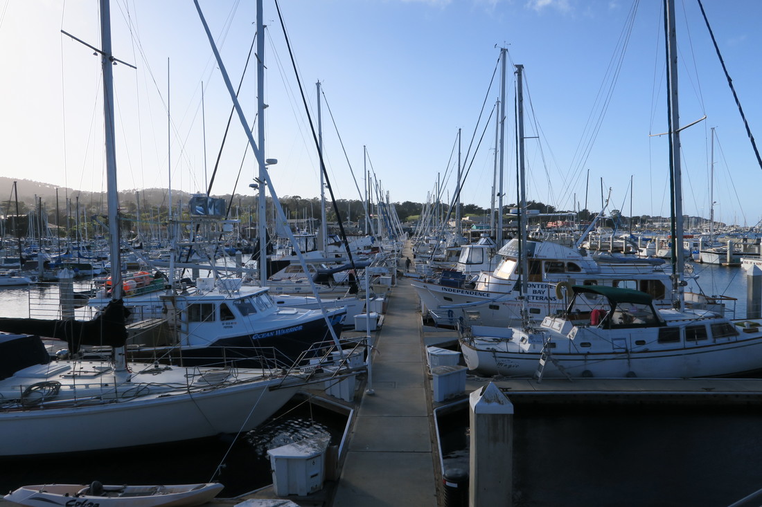
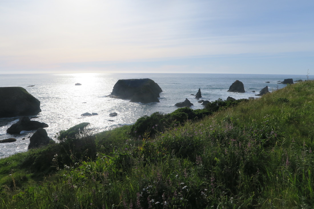
 Every time we visit a busy National Park, I think about how many photos each of the hundreds of thousands, and in some cases, millions of annual visitors take. My guess is that it's on the order of 100. So that’s like 10 to 100 million photos per year, per park. And don’t say that the visitor count includes kids – they take photos these days. Much less visited, photographed and blogged are many of the National Monuments. Chiricahua in Arizona, the subject of one of our previous posts, is just remote enough that vacationers don’t get there as often. Another is Dinosaur National Monument that straddles the Utah and Colorado border. It is sort of close to Yosemite and Grand Teton National Parks and also to Arches and Canyonlands National Parks, but not close enough that you can easily swing by when you fly into those places for vacation. I could write with praise about almost every long drive that we have done and most do have at least something spectacular to share. The fastest route from Grand Teton National Park to Dinosaur took us from Wyoming into Idaho, then Utah, and finally into Colorado. The highlight of this leg was the Flaming Gorge National Recreation Area. It was our first taste of Utah and the mesas, layers of salt, red and yellow rocks and canyon overlooks heralded things to come. We also saw a large but elusive animal that we’d been on the lookout for since at least Arizona: The drive to Dinosaur was noteworthy in other ways. We planned on dry camping on free Bureau of Land Management land, so we had filled our fresh water tank with 10-12 gallons of water, which meant our Keystone Bullet trailer was a heavier load than usual. The route plan was also one of our longest, close to seven hours – a long tow for a certain cat. So when we finally got to the turn at the visitor center for the southeast entrance to Dinosaur National Monument, we were anxious to see what this ‘off the grid’ location was like and set up. It was 12 miles, almost all uphill to the site. About six miles in, The Beast flashed a light and a message indicating a tire pressure sensor fault. We had seen this come and go many times and I’ve discussed it with my mechanic cousin Jay, so we weren’t worried. About a mile later, another beep. I looked down to see a message I hadn’t seen before: Reduced Power. The truck then proceeded to behave like a four cylinder. Going uphill, towing our heaviest load, I couldn’t get it over 10 MPH. We had no cell phone service to google the message or call anyone. We couldn’t turn the rig around on the road, because the mountain desert roadside dropped away quickly from the edges of the pavement. So, we limped it up the hill at 10 miles per hour and it was painful. The tire pressure monitor warning kept going on and off, as well as another message about an overload of the exhaust management system. The exhaust management system on a diesel Ford pick up truck is a complex, somewhat mystical topic worthy of its own post, and in fact if you google it, you will find that it is an area of enthusiastic consumer study. Anyway, there were lots of lights and messages going on and I was trying to baby the truck along in case we might be doing damage by towing with it in reduced power mode. Those are the excuses I will attempt to use to justify the fact that, at about 20 miles per hour on a minor down slope, we missed the turn into our campsite. Although it was an impossible road to turn around on, we normally would have just gone to the next turn around, pull out or parking lot and come back. The problem, of course, was that in reduced power mode this was potentially a multi-hour problem that would need to be overcome with a highly annoyed cat. The only solution: to stop and back the trailer up, all the way to the turn. By the time I realized this, the turn was half a mile away. This is not a great distance to reverse, even with a long truck, although the road was curved. If you don’t know from experience, it is something else entirely with a trailer. Fortunately, there was not much other traffic, so I used up both lanes until someone was coming (it was easy to see ahead, but behind the trailer, not so much). Then I would have to pull forward to get everything back in my lane, losing ground, and waving by the sensible Colorado drivers who wondered what the hell this idiot from New York was doing. I rapidly discovered that there is no way to hand signal 'reduced power mode'. Anyway, we counted down each 1/10th of a mile and we made it. Not to be boastful, but I sort of found my groove and added the 'high speed half mile’ to my hard-earned trailer reversing skill set. I hope I never need it again. We made the turn and our campsite was immediately on our right. I stopped in front of it and we looked at each other like, “is that it?” We had the huge site in the picture below with a fire ring, breathtaking view and ample parking all to ourselves. We stayed there two nights and wish it had been more. 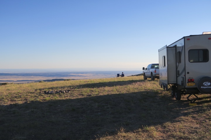 Dinosaur National Monument has two sides. One of them is the source of the most dinosaur bones in the world. They have an indoor/outdoor structure over an incredible quarry where you can see hundreds of bones, all together and embedded half-exposed in the rock. If you are interested in dinosaurs, it’s pretty one-of-a-kind. It's also great for kids – one of the rangers was running a presentation for a bunch of happy children sitting in a circle right across from of the giant fossil wall, touching dinosaur bones and asking all sorts of insightful and zany questions. The museum and the canyons are hot in June, but the overviews and campsites at elevation were a reasonable high-70s even in the midday sun. Which is a good thing, because Sonny the cat doesn’t have air conditioning when we are off the grid, and the heat makes him tired and crabby. 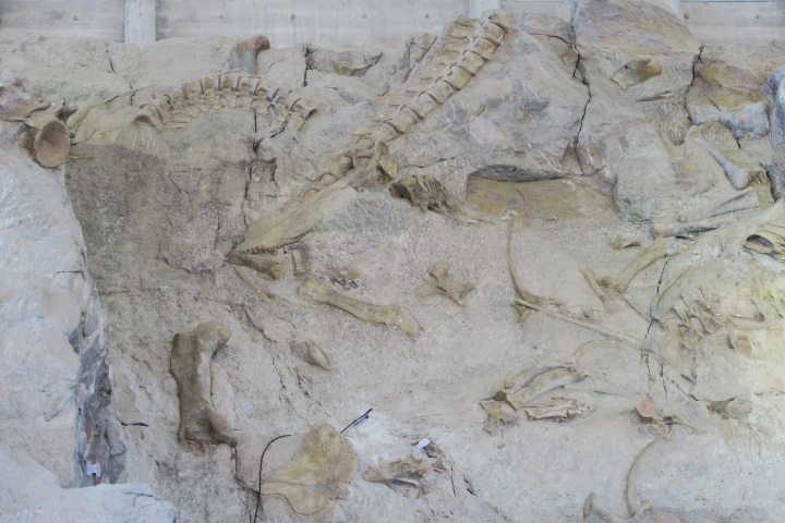 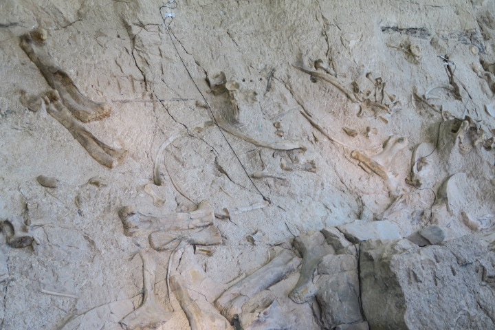 Shane Write something about yourself. No need to be fancy, just an overview.
0 Comments
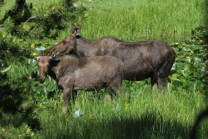 We started looking for moose in earnest at Kootenai National Forest and Lake Koocanusa when we stayed in Libby Montana. (Strangely the lake's name is the first three letters of the Kootenai River, Canada and USA.) The website for the lake promises that "Viewing opportunities abound for deer, coyotes, river otter, moose...” The word “abound” got me excited, but no luck. Great area though, and incredibly devoid of humans, even for Montana. Kathryn mused that bears would eat my body before anyone found it, whatever that means. We also failed to find moose at Glacier National park, even though the park and the town of Hungry Horse, near our campsite, sold moose-themed tourist gear. In hindsight, there is a stronger focus on grizzly bear and huckleberry signs, statues and mugs in that town. After dropping a zero-moose in Montana, we were obviously beginning to worry about the success of our entire road trip. When we pulled into the campground in West Yellowstone, I jumped out of the truck and went into the office to check in. I was lucky to find one of the owners, Ken, behind the desk. Ken gave me a very extensive run down on restaurants, sites, the current location of the bison herd in Yellowstone and other tips. When he heard that we had already seen bears and elk but were hoping to see moose, he told me that if we didn’t find any in Yellowstone, he had an “ace in the hole” location where we would have the best chances of seeing moose. We did not see any in Yellowstone, so on our last night in the area, we followed Ken's advice and drove about 15 miles into Idaho, to Big Springs loop, which is an area maintained by the US Forest Service, and is adjacent to Caribou-Targhee National Forest. The loop is a long, dirt road and the only other vehicles that we saw were recreational ATV’s. The area is popular for ATV riders, and there are lots of dirt trails for them around Big Spring. We drove very slowly around the loop, and even ventured a bit off of the road once or twice, all the while looking out of both sides of the truck for moose. We made it most of the way around the loop and were getting ready for disappointment when we saw a road leading down to a boat launch. It was deep pot holes all the way down to the small, deserted boat launch parking lot. Off to our left, across from the launch, we could just make out a meadow through the trees. I burst out of the truck and went into the woods toward the meadow. Kathryn yelled that I should take our bear spray, which would indeed have been the wise thing. When I got through the woods and onto the edge of the meadow, I scanned across it and couldn’t believe my eyes. I crept back to the truck, quietly jumping up and down and waving to Kathryn. After some high-pressure component swapping comedy with our camera equipment (camera wasn’t charged, video camera was charged, but had no memory card) we returned to the field and got some good video while watching a hungry lady moose through our binoculars. She was a big sow, even as moose go. The field was wet, full of blooming lupine flowers and among the top three places I have ever been for sheer mosquito density. t was so bad that I’m not sure that Thailand and the Amazon are the top two. This success made us very proud; even Sonny was impressed. However, our next stop was Grand Teton National Park, and only a few days later, while hiking the trail between Heron Pond and Swan Lake, we passed a pair of women who excitedly told us that there were two moose in the water at the other end of the lake. So, among bright yellow blooming lily pads, we got to see a medium-sized mommy moose and her small youngster. (Picture at the top of this post.) Which was cute, I guess, sure, OK. But it goes without saying that our laser focus by that time was finding American Beaver. That's another story. Shane
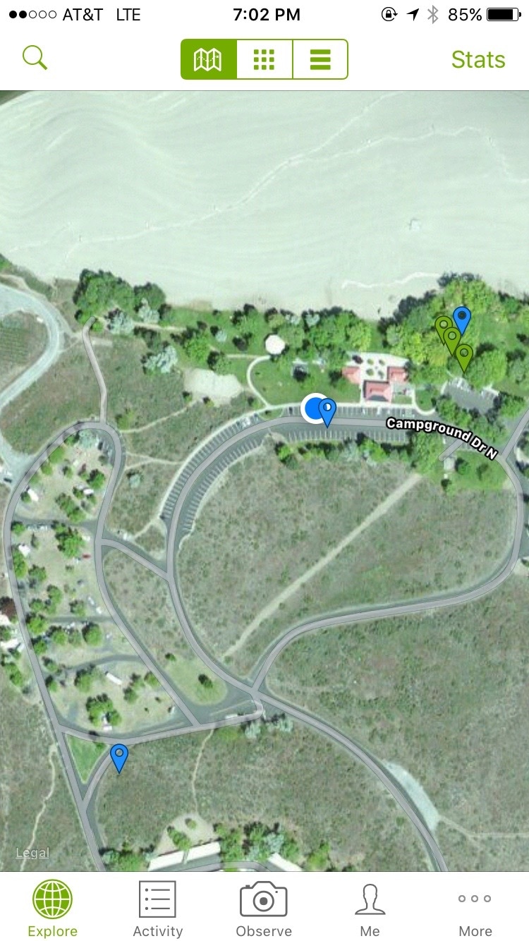
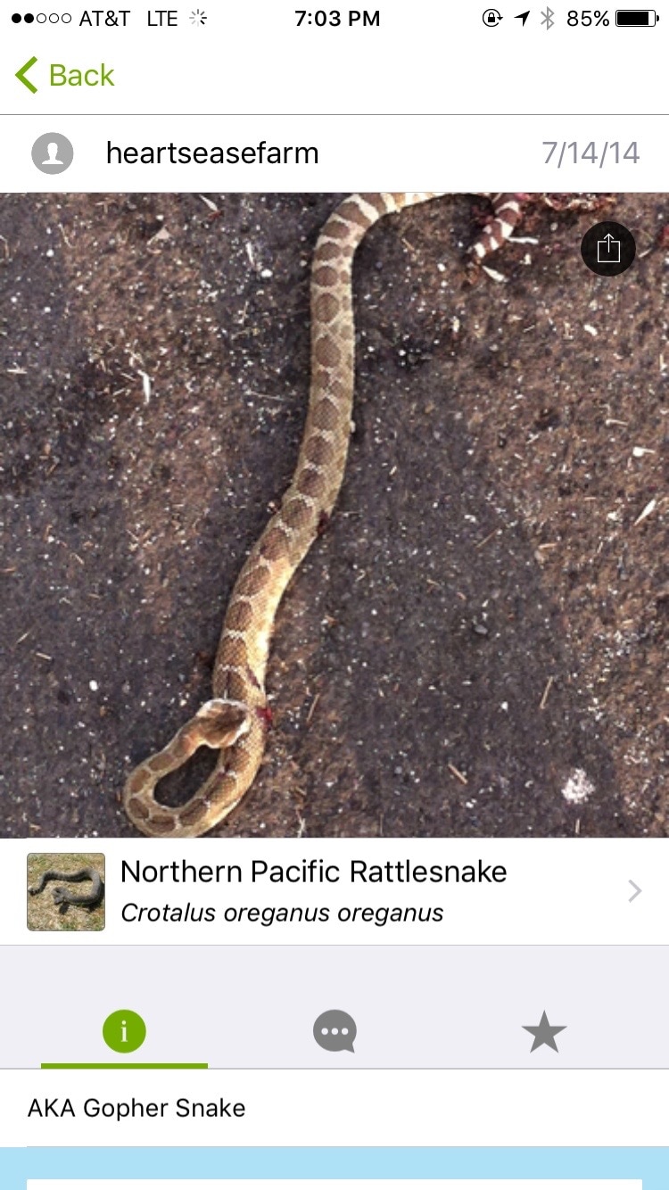
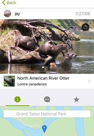 Today’s post will be a quick plug of an excellent project called iNaturalist.org. It is free and I don’t have any affiliation with it, I just like it. I’ve been using it for about five months now (since Texas) and it has made the wilderness parts of our adventure more fun and educational. The project has a website and a mobile app, which allow you to record photos of wildlife and upload them, share them with the community, and get help identifying them and discussing your findings. It is also great for figuring out the name of an unknown plant or animal, and sometimes even for locating wildlife that you want to see. At it’s simplest, it works like this. You take a photo of a mushroom, flower, animal, or whatever with your phone, which geo-tags the location using GPS. Then you use the iNaturalist app to share that photo. You can browse/search their field guide and tag the photo with an identification, if you think that you know what the organism is. Others can comment, or provide their own identification. You get alerted when someone has identified your subject, and click a button to agree with their identification (or not). After the ID has reached consensus (or an expert/scientist has reviewed and confirmed its veracity) your photo is elevated to the status of research grade, which means that it can be used by researchers who are interested in what plants and animals were seen, where and when. They can tell, for example, how wolves have migrated, whether an invasive fish species has reached The Great Lakes, or what effects the rain in California has had on seasonal blooms and wild bees. Below is an example of one of my photos. Some folks identified it as a Beach strawberry. These also serve as a nice notebook for what plants and animals we see and where. You can use photos from any camera, but unless it has GPS you will need to manually tag the location. 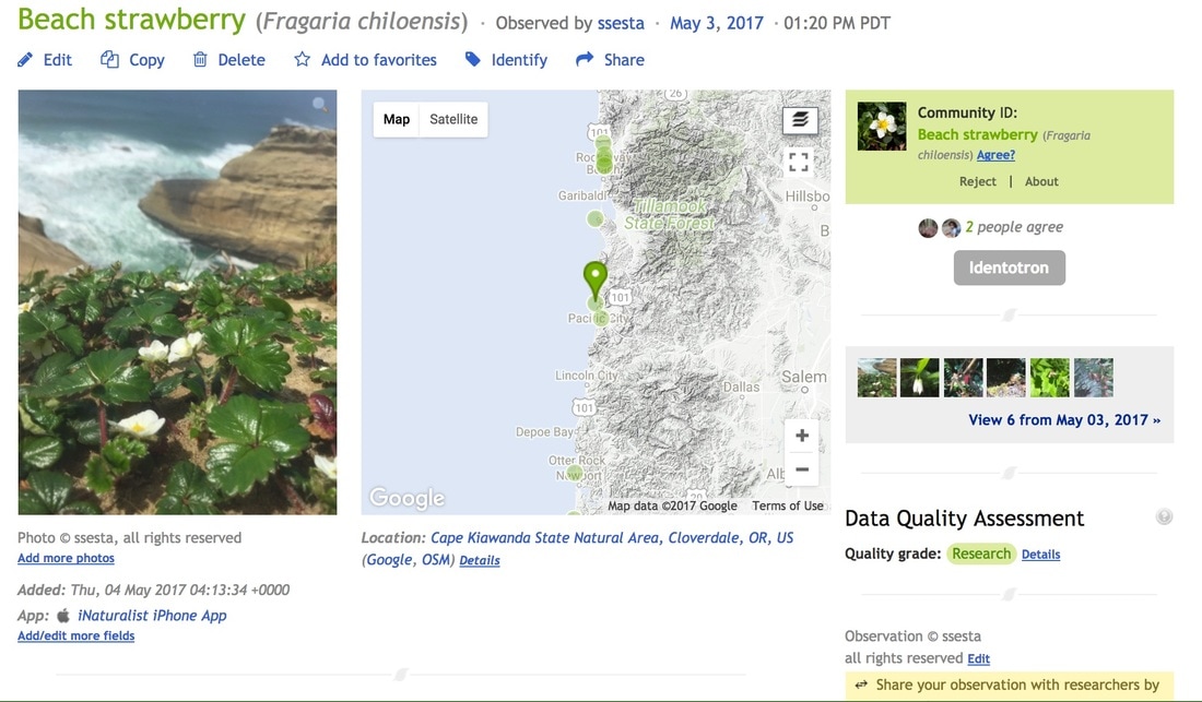 The most useful part for travel is that you can access that information too. There is an 'Explore' feature that lets you see other people's uploads, with color-coded tags on a map. So, if you don’t want to run into grizzly bears, you can see where they’ve been spotted. If you do want to see river otters, you can at least make an informed attempt at being in the right place at the right time. This can of course be a blessing and a curse – below, for example, is a phone screenshot from a park near Grand Coulee Dam in Washington. I got out of the truck, looked to see what animals might be in the area, and found an observation (the blue tag) from the parking space next to our truck.
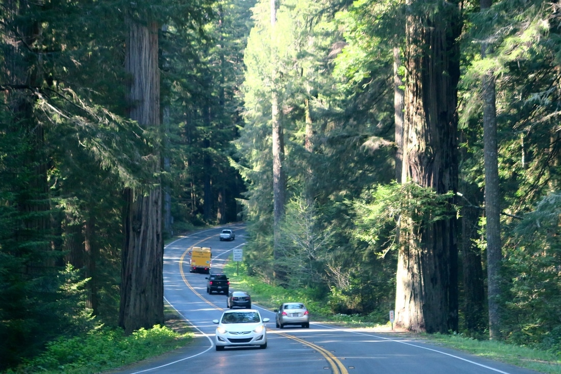
iNaturalist.org is just one of the great new sites working to crowd-source scientific data gathering and analysis. If you are interested in astronomy, another cool one is planethunters.org, which I learned about on NPR's Science Friday podcast. Planethunters is just one of over 100 projects affiliated with Zooniverse, a platform specifically for launching people-powered research projects. Data science and machine learning are advancing at the rate of science fiction, and these systems and models are just starving for large, quality data sets for analytic and AI training needs. A corresponding explosion in research funding for biology, physics and other sciences is probably not coming any time soon, but maybe we amateurs can get involved to collaborate and help create data sets while hiking, bird watching, fishing, stargazing or snorkeling, and have some fun in the process. AuthorShane When we started planning this trip, one of the biggest questions we had was how on earth we were going to pull this off with our cat Sonny in tow. We were going away for a year, so he was definitely coming with us, but how was that going to work, exactly? We wondered if he'd be miserable, or worse, that he'd escape into the wilds of Yosemite National Park or something and never be seen again. When we started researching road trips with cats on the internet, we didn't think there would be much information. This, of course, was stupid. Cats rule the internet and there a loads of websites and blogs about adventuring, RVing and traveling with cats. There are even first person accounts from cats about their experiences. No, really! Armed with this information, we bought a massive cat traveling suite (actually a carrier for a large dog), which takes up most of the back of The Beast. We also bought a collapsible enclosure that we stick outside when we set up camp so Sonny can hang out with us when we're sitting outside the trailer. Our last purchase for him was a harness and leash, so that we could confirm everyone's suspicion that New Yorkers are urban hippies: "Hey, look at those New Yorkers with a cat on a string!" We tried getting Sonny used to the harness while we were still at home, but this proved useless, because he was used to going outside on our apartment roof deck without one, and he is not an idiot. Every time we managed to wrestle him into it, he just lay down on his side like a dead fish and refused to move. Now we're the road, though, and he has realized that he can explore sand dunes, beaches, forests and wade deep into puddles and climb up palm trees when he goes for a walk, he purrs and runs to the trailer door every time we get his harness and leash out. The fact that he gets a treat at the end of every excursion probably also helps. At first, he was a little cautious when we took him out, preferring to explore the immediate area around the trailer. Not any more! Check out the slide show below for pics of some of his outings. Now we've realized how adventurous Sonny is – and unafraid to get his paws wet –we've been speculating about his former life before we adopted him at the age of four. Top theory: he was a boat cat back in the day, working his way up and down the Mississippi on a paddle steamer. Or maybe he just has mountain lion relatives that we don't know about, still mooching around Big Bend's Chisos Mountains. While some of our fellow campers have done a double take seeing a cat on a walk, or rather more accurately, Sonny taking us for a walk, others have stopped us to say that they have been traveling with their cats for years. In our Miami campground, we even saw someone had strung a zip wire a few feet off the ground between two trees and attached the leashes of two cats to it so they could wander around. The biggest challenge has been actually driving between campgrounds without a chorus of yowls coming from the back seat. Sonny does not like being on the move, and although we've tried using a cat calming spray and he has toys, snacks, water, a blanket and a bathroom in his cat carrier, he only really settles down if he's sitting on a human. Cats are supposed to be secured in a carrier in the towing vehicle when you're on the road, but when we're on a particularly long drive, Kathryn gets in the back with him, so he is either inside his carrier or restrained on her lap. This, of course, is great for Sonny, but not so great for us! 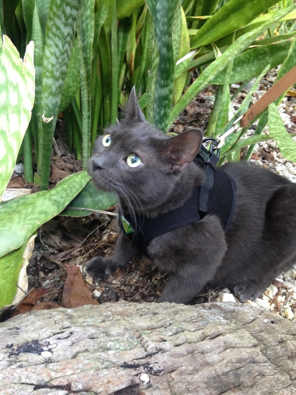 There have been other cat-related mishaps along the way, of course. Here are a few tips from what we've learned so far about traveling with Sonny so you can avoid our mistakes: Keep the doors of your vehicle shut at all times when your cat is in it, even during short pit stops. We were worried about Sonny escaping from our travel trailer before we set off, but this hasn't been a problem because it has two exterior doors: one in the bedroom and one in the living room. Sonny stays in the living room while we go in and out of the bedroom, or vice versa. He has figured out how to Houdini his way out of his cat carrier in The Beast, though. When we stopped to put air in the trailer's tires at a Florida truck stop, we were horrified when Sonny strolled right up to us on the concourse to find out what we were doing. Kathryn had left the back door of The Beast open while we were stopped for five minutes and he slipped the carrier and walked right out. We both nearly had a stroke and yelled "caaaatt!!" at each other, before one of us came to our senses and scooped him up. Test out how your cat does in a harness before you venture too far outside. We tried out two different cat harnesses and a dog harness before we found one that Sonny has trouble escaping and he can even back out of this one (pictured above) if he really sets his mind to it. Don't leave your cat outside on a leash unattended and be ready to grab him if he makes an escape. Make sure your cat has enough ventilation. Keep all the windows of your vehicle cracked if you have to leave him unattended while on the road. We have only left Sonny for 30 minutes at a time and never when it's been too hot to leave him without the air conditioning running. The interior temperature of our Keystone Bullet trailer stays much cooler than the inside of The Beast, but we always crack all the windows and open all the vents when he's going to be in there on his own for a few hours, and if it's really hot, leave a fan running. Watch for slide outs! Our trailer has a motorized section that extends three feet when we set up, which makes our living area bigger. We've heard stories of cats getting trapped in the machinery, so ensure your cat is safely secured in the towing vehicle when you extend or retract any slides. Check ahead to find out a campground's pet policy. Most allow pets on leashes, but some don't allow animals outside at all. Bring paperwork to show your cat is up to date with vaccinations, particularly for rabies. We haven't had to show this yet, but some campgrounds require it and we will definitely need this when we cross the Canadian border. Make sure you treat your cat for fleas and ticks before you allow him to explore new habitats. You don't want your cat to pick up any of these and you certainly don't want any of these critters inside your trailer! We're sure that not all cats are happy campers, but we've been pretty amazed about how well Sonny has adapted to life on the road. We keep telling him that he's the most well-traveled rescue cat from Greenpoint, Brooklyn – or at least, one of the top three. Kathryn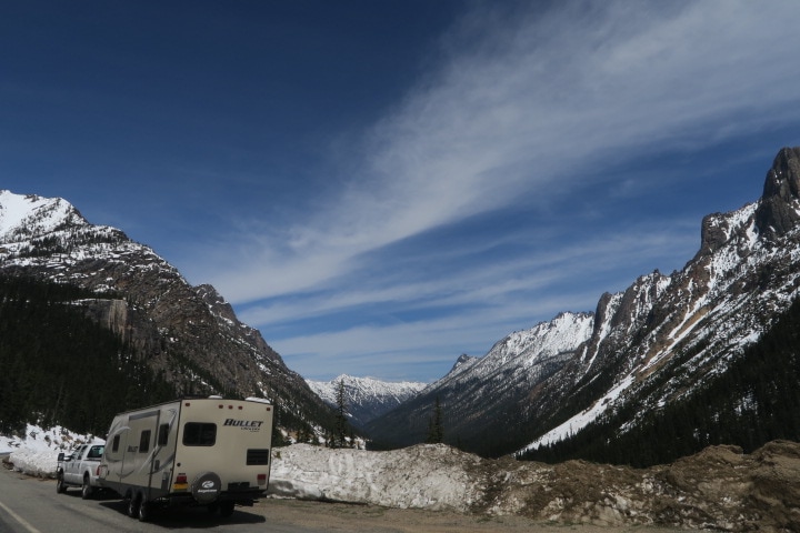 When I look back on my previous posts, gushing about scenic drives, it is quite often the case that the scenery that I just finished gushing about on the blog is quickly surpassed, or becomes so commonplace that we realize that the local population considers it boring background radiation. A very superior drive that I did not post about, but would have fallen into this category, was the drive along famous California Highway 101 into Redwood National Park, which is indeed remarkable for several reasons. The trees are so tall on either side of the road that the sky above is reduced to a narrow sliver of light, hundreds of feet above, and there is absolutely no hope of seeing anything more than a few meters from the shoulder. This was the first slot canyon of wood and ferns of its type that I had ever seen. And yet, occasional deforested breaks, and constant “Entering tsunami evacuation zone” and “Leaving tsunami evacuation zone” signs remind the traveler that the rough, rocky coast is never far away. Occasionally, without ever leaving the admirably well maintained and trailer-friendly roadway, we found ourselves suddenly agape, among a grove of true 'giants', a sobering reminder that most of the individuals in these epic redwood corridors are young adults from the era of George Washington or Shakespeare, but with luck might survive to be as old as Jesus, or even Homer, would be today.
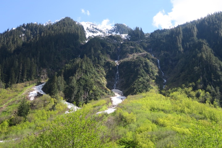
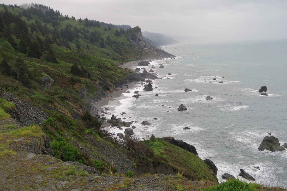
All of that to say that the trip north, OUT of Redwood National Park was replete with even more deep, dense corridors, soaring giants, bluffs, bays, and buttes. Also, that drive, following the Rogue River north into Oregon, brought us to our first really green water. Waterways that are fed by rain runoff or snow melt are the kind that we were used to. Most of our international travel has been to temperate, sub-tropical, or tropical climes without glaciers, so we’re used to clear water in creeks and streams or muddy/silty river water, with the occasional exceptions caused by microbes or mineral content. The streams and rivers in the Sierra Nevada mountains, i.e. Sequoia and Kings Canyon and Yosemite, had a skim milk quality, which we now realize was because it was partially glacial melt water. (We visited those places in spring, so there was a lot of snow melt mixed in.) Glacial water, as we have read about at dozens of information stations since, contains a high quantity of 'rock flour', from grinding during glacial formation and evolution. This gives the water an opaque quality, and a milky, blue/green appearance. Our aforementioned drive from Redwood National Park to the Valley of the Rogue, along the Rogue River, rewarded us with our first opportunity to delight in this ‘green water'. The trip up to Crater Lake and beyond into central Oregon gave us an opportunity to compare soapy green creeks with crystal clear snowmelt streams. At Mount Rainier, the ranger station and placards at overlooks spelled this comparison out to us, and we were then able to share this knowledge with my mother as we followed and crossed the wheel-spoke rivers flowing from the Olympic mountains as we circumvented the Olympic National Park peninsula.
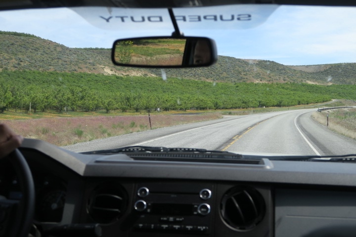
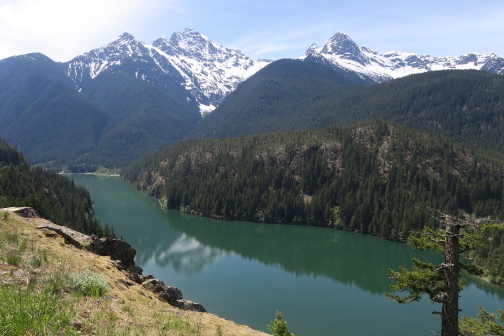
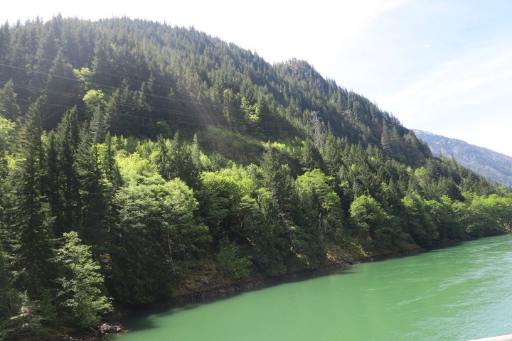
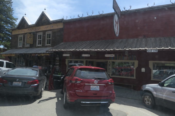
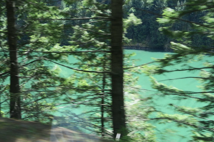 Poor but unenhanced photo from the truck window of very green Skagit river water. The reason that I’m telling you this is to make it bluntly clear that by the time we got to North Cascades National park, and to the Skagit river, we had seen our share of green water. Translucent, emerald green. Turquoise, powder blue-green, limewater, mountain-dew-the-beverage green. For further context, we were familiar with France's Gorge du Verdon fluoride green and the reflective salt-water green of Emerald Lake in Thailand’s Ang Thong National Park island paradise. That being clear, when we were driving along Route 20, the Cascades Scenic Highway, with the Skagit river to our right and the Cascades rising before us, and I was pointing as emphatically as one can while pulling the trailer, Kathryn commented, “My god, it looks like they have colored it for some sort of Saint Patty’s day celebration”. The way I'll describe it: imagine chocolate milk, if chocolate milk was green. In summary, the drive from the Cascades begins with the best green water yet. Hydroelectric dams have created small, managed green lakes among the mountains. The highway follows the river into the foothills, through typical Pacific northwest forest, thick with conifers, ferns, and moss. Then the highway leaves the river and the switch backs begin, winding upward to better and better views, with fewer and fewer green plants between the conifers, and finally to snow. After photographing these peaks from forest hikes, paved overlooks, and dodgy dirt pull-outs, we were now among them. The highway crests in such a high mountain pass (Washington Pass, 5477 feet) that we didn’t have to crane our necks. In late May, roads to scenic views and trailheads were blocked by many feet of snow and ice. Each closed intersection blossomed with a disorganized scrum of SUVs. Most of their owners were climbing onto the snow with cameras, but some had hiking poles, and a reasonable number had packs that were hitched with skis. 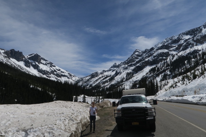 Just east of Washington Pass The eastward descent is abrupt, and the other side of the Cascades is a completely different world. The Washington State license plate reads Evergreen State, below a picture of Mount Rainier, but that’s not the whole story. If ferns and moss have ever lived east of the Cascades, it must have been before the last Ice Age did its work on the landscape. Two hundred-foot trees were replaced with scrub trees, and bare, ancient Gneiss were replaced with red, high desert plateau. As the descent ended, we were back in the high desert that we learned about in Oregon, not surprisingly, at the same longitude. Next came the extremely cute, touristy town of Winthrop, sporting old-west facades, hip shops, enticing eateries and facilities for RV parking and town-touring bike rental. So we definitely would have stopped there, except... cat. The road passes through a bit more high desert, and the awesomely named town of Twisp, until suddenly, small leafy trees rise in rows reminiscent of California’s central valley. Approaching long, thin Lake Pateros, we entered industrial apple farmland. Do not picture pastoral east coast grassy hills covered with apple trees. Previously, when told that Washington State was the leading producer of apples, I was like, “Of course, it is roughly the latitude of New York. Why not?" But it isn’t like that. As we drove around the lake, which is bordered by a few very large apple processing and packaging facilities, on both sides of the road, a fertile belt of apple rows extends maybe 200 to 400 yards from the edge of the water, in every direction, over every topographical feature. The reason the belt is fertile is that it is irrigated from the lake. Heavily. Literally one truck-width beyond the apple belt is a sandy scrubby desert. It is a very pretty (and, in May, blooming) desert, but the irrigation terminus line is jarringly abrupt. Given the natural beauty of the surrounding environment and, being honest, of the manmade lake, it was disappointing to see California-style water management battlegrounds suckling The Cascades' river nectar so close to the parkland still in our rearview mirror.
 Arid apple farm Not long after this, the desert gets even more arid, and there are bone dry washes and knee-high foliage reminiscent of the southwest. This soon changed again as we ascended, gradually but continuously, and things counterintuitively got greener and grassier. Soon we were in the high plains. The foliage didn’t cover our shoelaces and we could see forever. We could see The Cascades, three hours drive behind, so clearly they appeared a short walk away. Hundreds of clouds diminished into distant horizons. Sonny mentioned that in his youth as a cowherd on the prairie, one of his nicknames was High Plains Drifter, but we diplomatically reminded him that is the name of a Clint Eastwood movie from before he was born, as non-confrontationally as possible, not bruising his ego. And indeed it is cattle country, beef cattle from what we saw, although despite tempting watering holes and tall grass, the cattle density was low, and we mostly saw wide, boggling expanses of fenced but empty plains. Then we descended to our destination at Grand Coulee Dam, one of the main reasons for all those irrigated apple farms, and a canyon opened before us. I could convincingly market road footage from this drive in video guides for British Columbia, Texas, Central California, and New Mexico. We are only halfway across Washington State, but I bet we’ve also seen the greenest water ever. Or maybe until Glacier National Park in two weeks, but what are the chances?
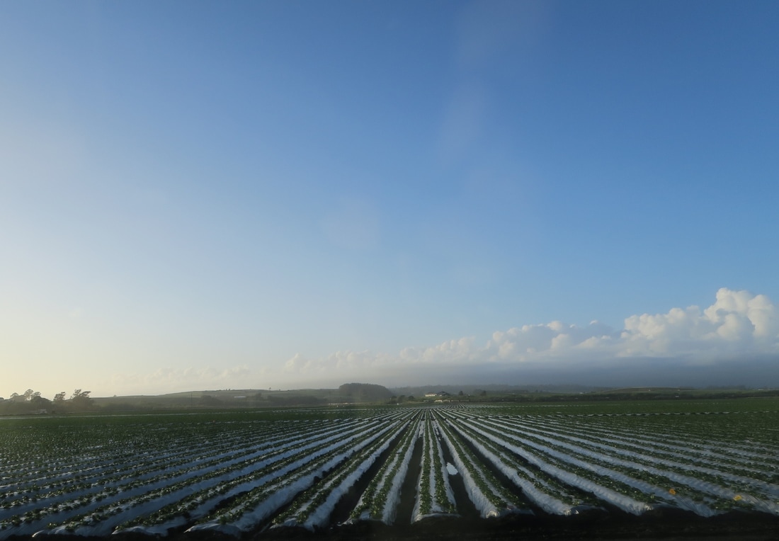
 This is Washington State AuthorShane 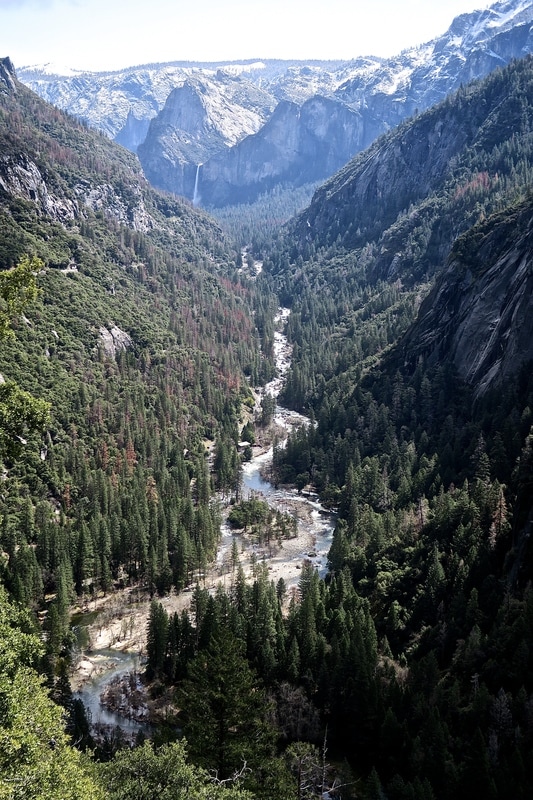 A view of Yosemite Valley, Yosemite National Park. We’ve just left California after eight weeks there. It was a long time in one state, but you can easily spend eight weeks in California and feel like you've visited eight different countries. We did explore six different national parks while we were there – Joshua Tree, Death Valley, Pinnacles, Sequoia and Kings Canyon, Yosemite and Redwood – but that’s just the beginning of the incredible diversity of the place. California may be vast, but it's still almost impossible to reconcile the facts that the Mojave and Colorado deserts in the south and the old-growth coastal redwood forests in the north, where everything is green and sprouting and dripping with moss, are in the same state. Or that the snow-capped Sierra Nevada mountains quickly give way to the millions of acres of farmland in the Central Valley, where we passed billboard after billboard belonging to farmers protesting about water rights. Or that you can drive two hours from Sacramento to San Francisco and the temperature can drop 30 degrees. 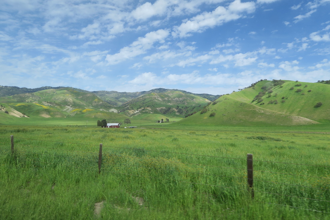 Some of our shots of farmland near Pinnacles National Park could have been taken in England or Wales. There were other surprises too. We did not know, for example, that the Monterey Bay National Marine Sanctuary contains an underwater canyon that is 12,713 feet deep in one spot, larger than the Grand Canyon, which you can reach less than half a mile off shore. We didn't realize that you have to drive six hours north from San Francisco to reach California's border with Oregon. We didn’t expect to see oil rigs from the beach where we camped in Huntington Beach, Orange County. And we were pretty amazed that in a state that is light years ahead of others in some areas of environmental protection, Los Angeles still has the worst traffic problems in the country and four of the most congested freeways in the world. Back to the highlights. After Shane's post about Los Angeles, Death Valley, the Kern Valley, and Sequoia National Forest, we camped at Lake Kaweah while visiting Sequoia and Kings Canyon National Park before heading west to Pinnacles National Park and then on to the coast, where we explored the area between Carmel and Santa Cruz. We then headed north and east, crossing the state again to camp on the Merced River and visit Yosemite National Park, before heading back west to Sacramento and then on to San Francisco and Marin County. We then traveled north up Route 101 through Sonoma and into Mendocino, before making our very last stop just south of the Oregon border at Redwood National Park. I could write a chronology of all the places we loved in that time, but that would be a loooong post, and we're already documenting our daily progress on Facebook, Twitter, Instagram and on the Live Route Mapper on this blog. Instead, along with a selection of photos in the gallery below, here’s an extremely potted version of our favorite California travel moments since leaving Sequoia National Forest. It's almost impossible to distill my kaleidoscope of memories from the last few weeks into a few brief points, but I'm going to try anyway:
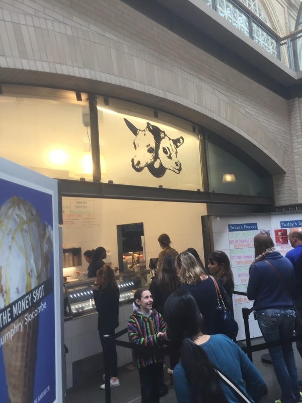
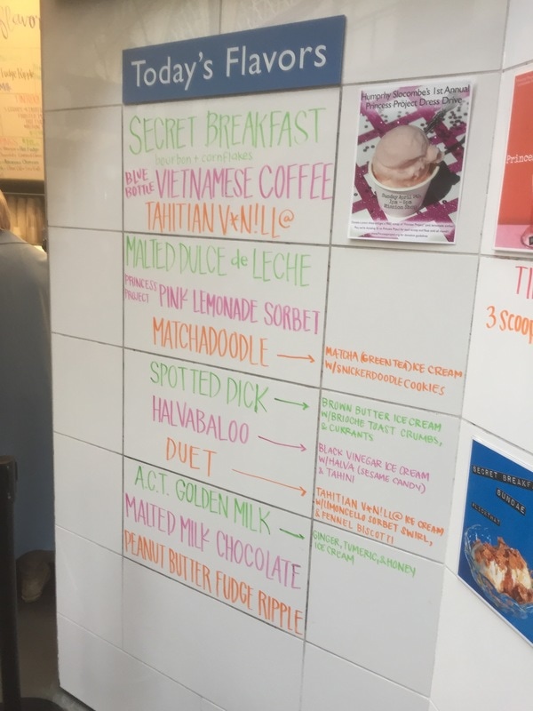
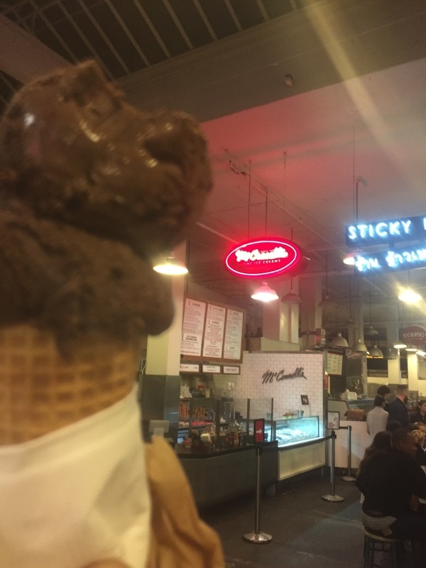
A final highlight I should mention was exploring Steinbeck country right after reading John Steinbeck’s Travels with Charley, his account of the three-month US road trip he took in 1960 in a state-of-the-art truck camper, which he named Rocinante, with Charley his poodle at his side. Doing a very similar road trip ourselves, we can understand why he felt so much affection for his home on wheels, and we were also strangely reassured to learn that, just like us, even John Steinbeck suffered flat tires and plenty of other mundane camping setbacks. Mostly, though, it was fascinating to read his observations of 1960s America and of California's Salinas Valley where he was born. Returning there after many years, he was shocked that Salinas, which he recalled having 4,000 citizens, had grown to 80,000 residents, and preferred to remember the Salinas Valley of his childhood, "the permanent and changeless past where my mother is always shooting a wildcat and my father is always burning his name with his love". I wonder what he’d make of the fact that Salinas now has over 150,000 residents, that its Main Street is now dominated by the National Steinbeck Center, and that Rocinante is one of its exhibits? Either way, the National Steinbeck Center is really excellent and our unexpected encounter with the magnificent Rocinante there was yet another treat. We loved our California adventure. AuthorKathryn 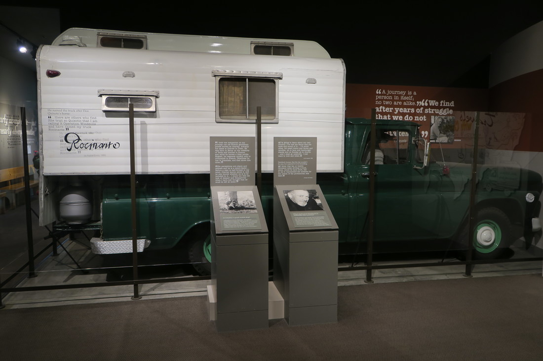 John Steinbeck's 'Rocinante' at the National Steinbeck Center in Salinas. 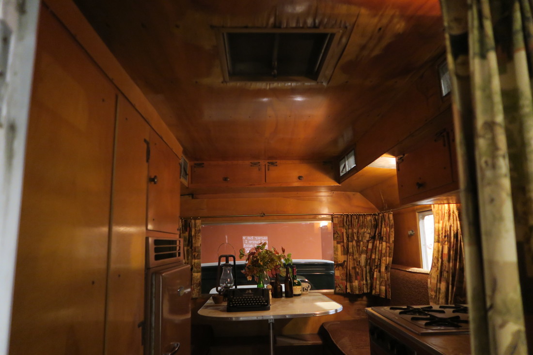 Inside 'Rocinante'. We've put together a quick slide show of some of the beautiful wildflowers – and mushrooms –that we've seen in Oregon this month. Enjoy! 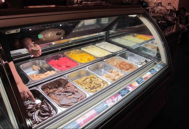 This is an Italian gelato stand in Berlin. It was the best ice cream photo I had, so I used it to lure you in. The near-empty slot on the bottom right was 'speculoos'. Delicious. I’ve been sampling ice cream and gelato from top-rated shops around the country. Along with craft breweries and independent bookstores, the idea was to produce a series of reviews as we traveled, rating and contrasting regional and national champs. I have spreadsheets with partial, disorganized 'nation’s best' lists in a variety of categories, but no long-form beer, bookstore, or ice cream reviews. What prompted this post, then? After nearly six months, we visited an ice creamery that shot right to the top of my list, and it is Humphry Slocombe in San Fransisco. I'm not easily impressed by ice cream. Kathryn has asked me “What did you think?” about many famous eateries along our journey and has decided that I am impossible to please, because my usual reaction is a shrug and an “it’s ok”. For me, “it’s ok” is a favorable response, meaning: “If served this in NYC, I might return here instead of trying another (ice cream, sushi, thai, lobster roll, fish taco, whatever) place next time.” My feeling regarding Humphry Slocombe in this context is: “If this place was in NYC it would be my new #$%ing place”.
Ice cream shops these days seem to come in several types:
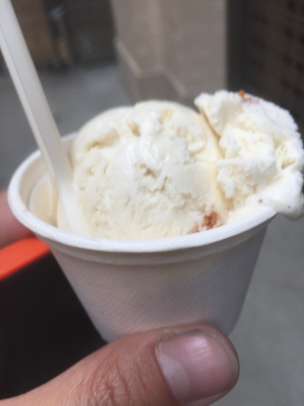
Humphry Slocombe falls into the last category and I hesitated to commit to the flavor that made them famous, 'Secret Breakfast', which is Bourbon and Cornflakes. I love both, but I’ve seen too many of these poorly executed. The line for ice cream was conspicuously long and I had plenty of time to make my choice. This brings me to a topic for which I have great emotion. The explosion of ‘fun flavors’ has led to a) delays in service while people share on social media and b) delays in service while some people taste every flavor before buying. I understand the desire to taste them all, believe me, but allowing people to do this hurts everyone. I heard that recently a kitten starved and died while the owner was busy tasting every single flavor at Max and Mina's in Queens. A lot of people are saying that a puppy or a baby bunny will be next. The phenomenon is not new. Everyone in line can’t believe how long each incompetent person being served/helped is taking, but when it is their turn, and no other humans are in front of them so the whole problem is solved, they take just as long to get everything perfectly right for themselves. Only it isn’t just that they weren’t ready to order ice cream in this case, they want to have a personal taste test and hold an unmoderated panel discussion with their friends before any scooping or paying can begin. Here is some free business advice to Humphry Slocombe and all of the Slocombes out there – provide TWO lines. One for tasting and one for ready-to-order customers. Make the tasting people happy and get your social media marketing, without losing customers from the end of the line who have limited time or patience for watching people taste ice cream. That said, I tasted a few flavors at Humphey Slocombe because just this once. Secret Breakfast does live up to the hype, but I chose 'Duet', which was billed as “Tahitian vanilla with limoncello swirl and fennel biscotti”. One of the best cones I have ever had anywhere. So creamy that in order for my world to make sense I had to invent a conspiracy theory where they have been evading/bribing FDA agents and are using unpasteurized cream and milk to cheat the UCI doping investigators. The next day we returned and ordered 'Spotted Dick', which was top quality but less of a favorite. They've been around since 2008 and you can find a ton of professional reviews on the place and all of the flavors. Even Wired, a tech magazine, covered them back in 2012. If I've piqued your interest, but you can't make it to San Francisco, they now have their own Ice Cream Book with instructions for making many of their popular flavors. Apparently they add some condensed milk in their “modified anglaise ice cream base", which may be what gives it that suspiciously not-pasteurized taste. I’d love to know which local creamery supplies them (there is no shortage around the bay area). Also, if anyone buys this book and wants to know if their home product is as good as the original, contact me to arrange dry ice shipment and I will taste it for you.
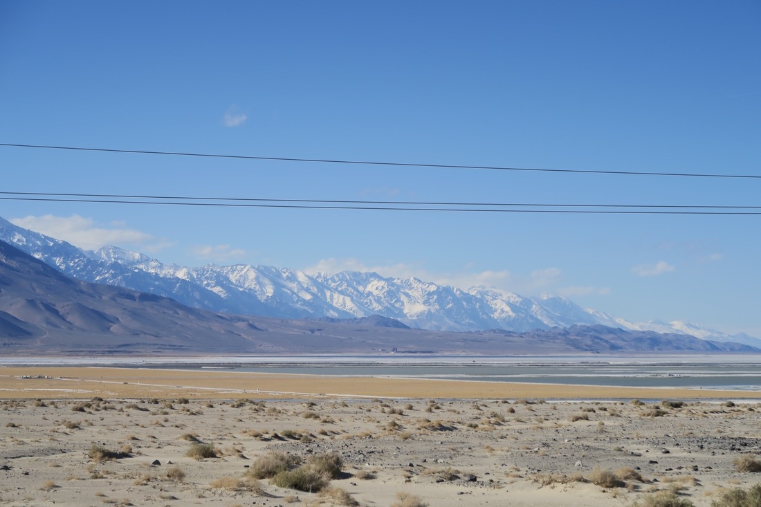
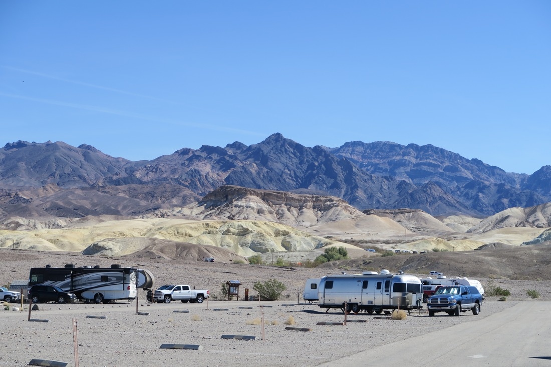
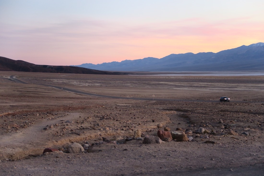
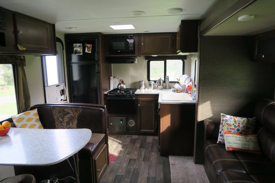 We've posted loads of shots of the outside of our trailer, but a few of you have been asking what the inside looks like, so here's our 2016 Keystone Bullet 248RKS in all her glory. You'll note that the prevailing theme is brown. We've no idea why the soft furnishings in Keystone's latest trailers look like they belong in the 1970s. Still, after doing months of research, we decided that this was the best layout for us of all the travel trailers we looked at, and we're very happy with our choice. Most importantly, all the really essential stuff we need for a long trip works brilliantly. It has loads of storage, excellent insulation, a powerful furnace for heat, efficient fans and air conditioning, and a fridge/freezer and hot water heater that run off propane gas or electric. It has really large fresh and waste water tanks for a trailer of this size, which has been invaluable when we've been camping off the grid in the middle of nowhere. It even has a flatscreen TV, a radio, CD and DVD player, an exterior shower, a gas-powered grill that we can hook up outside for BBQs, a sun awning that zooms in and out when you press a button, and exterior speakers. For trailer-dwelling nomads, we feel quite fancy! 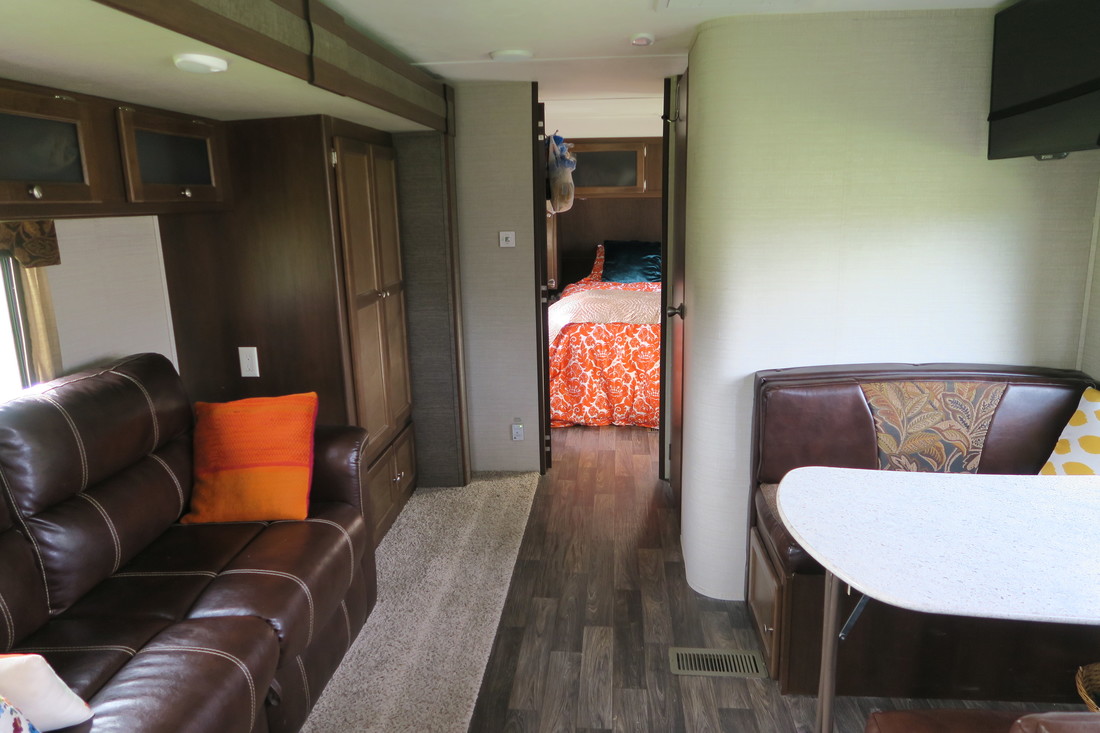 All of these pictures were taken with the three-foot-deep motorized slide out section extended, which makes our living area a lot more roomy. When we retract the slide out section to drive to the next camping spot, the couch and wardrobe slide in and sit snugly next to the dining/office area. The sofa folds out into a standard full/double bed for guests. There's a door between the bedroom and living room and also a second exterior door in the bedroom. This is crucial, because it means we have a cat sequestering mechanism. If Sonny is in the front half of the trailer, we can exit from the bedroom without him legging it into the wilderness, and vice versa. We can also put him in the bedroom while we retract the slide in the living room when we're getting ready to leave a campground without him getting hurt. Try explaining to an RV dealer that you need a trailer with two external doors and an interior door because of your cat and see what kind of looks you get. 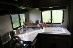 Like most New Yorkers, we are pretty good at living in small spaces. As Shane remarked, the kitchen in our trailer is actually way better than the one he had in his first studio apartment in Chelsea, which had a minibar-sized fridge, a sink and a hot plate. Actually, the kitchen in my first East Village apartment basically consisted of a sink and stove in a cupboard, so who am I to judge? This has a stove, a pretty big fridge/freezer and a microwave. All the mod cons! A lot of RVs have small galley-style kitchens, but because we have a corner layout, we also get more prep space. 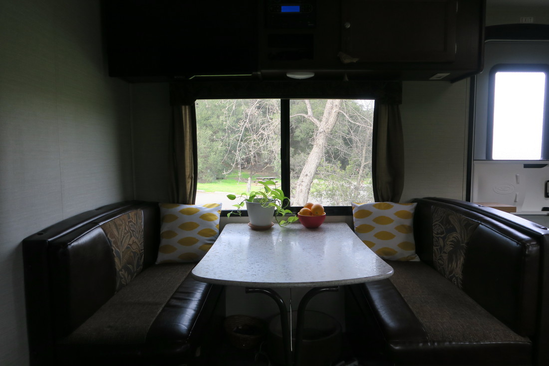 Here's the bathroom, with the shower stall to the right. There's also a toilet out of the frame. 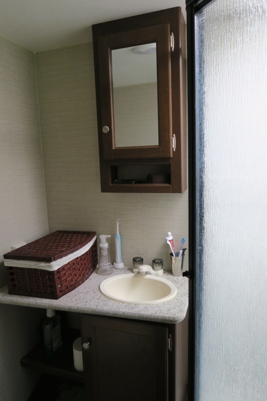 Here's the husband hard at it drinking beer in the kitchen... 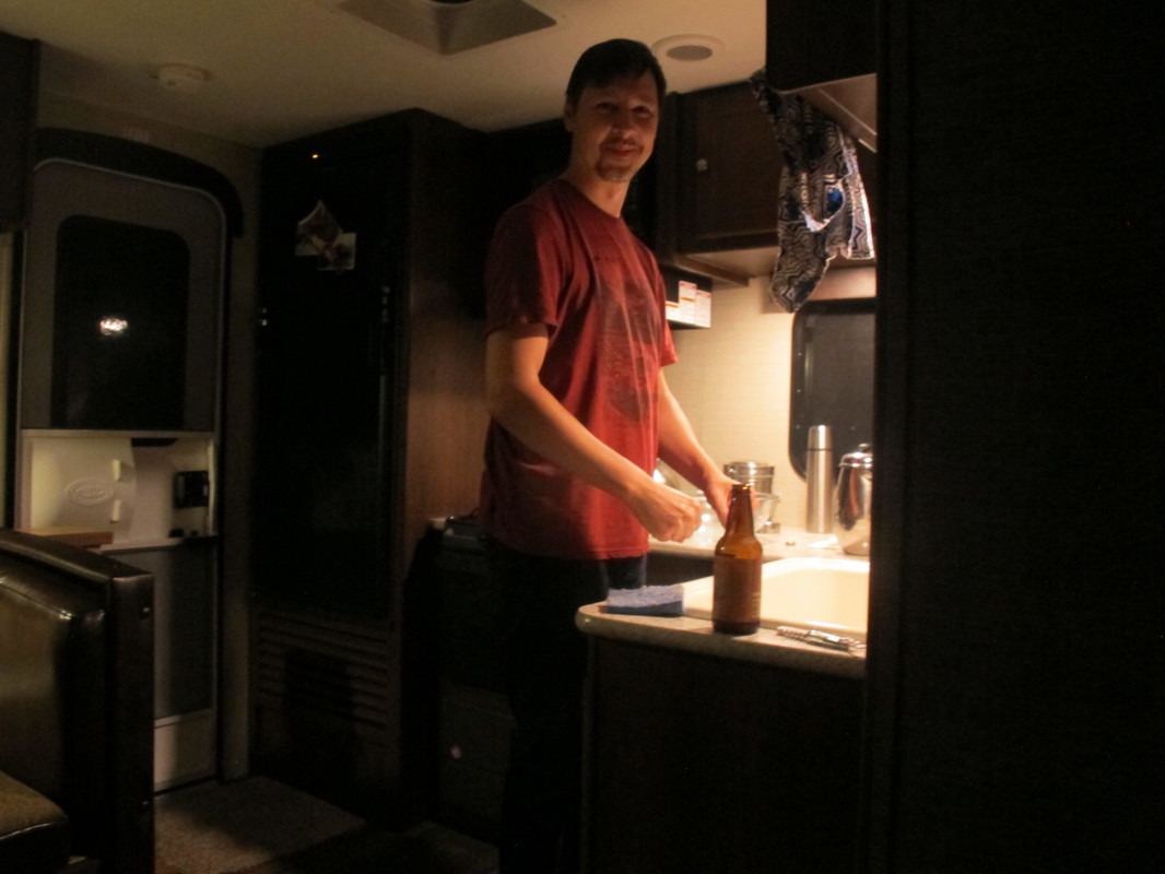 ..and here's a shot of the whole NYC Nomads team at work in the office. 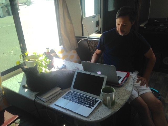 AuthorKathryn 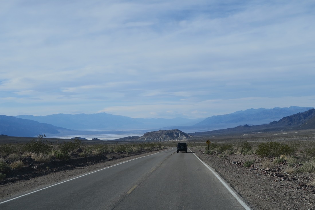 Driving back to our Death Valley campground, with the valley's salt pans in the distance. Between Los Angeles and Sequoia National Park, to manage the timing of arrangements with friends for Yosemite and San Francisco, our California plans included about a week in Death Valley National Park. Our expectations were, essentially, that it would be a place that wasn’t cold where we’d get to see some marginally interesting "very dry stuff”. No one warned us about the beauty of the roads in, out, and around the park. Leaving Los Angeles with the camper went smoothly but was still stressful. California drivers are very competent but also very, often pointlessly, aggressive. Meanwhile, highways in the LA sprawl zone split and merge every few miles. Drivers need to be in a specific set of traffic lanes at any time to stay on course. This actually keeps the heavy traffic flowing relatively efficiently, as drivers adroitly merge, and currents intersect, with less-than-usual backups at overcrowded exits. So California drivers are good at making a lot of lane changes. Unfortunately, selection pressure for this skill across the population seems to encourage a culture of serially obsessive lane changers. When things get congested, drivers constantly compete to cut into the fastest lane, executing last-second merges and multi-lane sweeps to maximize their spot in the queue. This causes and perpetuates the very stop-and-go congestion they are fighting.
We did not encounter much congestion on a Monday afternoon, but executing lane changes in this environment is unpleasant with a large trailer. Every few miles, my co-pilot would call out “get into the right three lanes,” or “left two lanes must exit, get over,” and The Beast’s 6.7 liter engine would bellow as the whole rig surged up to lane-synchronization speed, gradually and deliberately inserting itself between a 700-series BMW and the silver Hyundai with matte black primer hood cutting across two lanes in front of it. Within 90 minutes or so we were back onto more normal highways with New York expressway-style congestion and activity. Very soon after that, we escaped the LA commuter radius altogether and were on near-empty road. And back in the Mojave desert. Groups of joshua trees as fine as those in the Joshua Tree National Park became the roadside view for about the next hour. Reaching Mojave, population 4200, altitude 2762 feet, we stopped for fuel, and grabbed takeaway from a donut cafe / deli named Stoken right behind the gas station. Their counter features a great variety of hot and cold sandwiches, ice cream and fresh donuts, and is highly recommended. At lunchtime it seemed like half of the 4200 inhabitants of Mojave were either there or stopping in, the mailman included. Inside the door was a cork community board for lost pets and classifieds. Employers in Mojave have openings for experienced tradesmen. Mojave has an ample talent pool of test pilots looking for work.
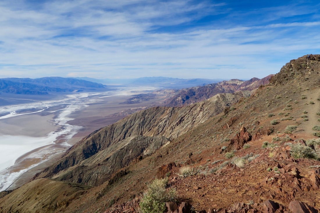
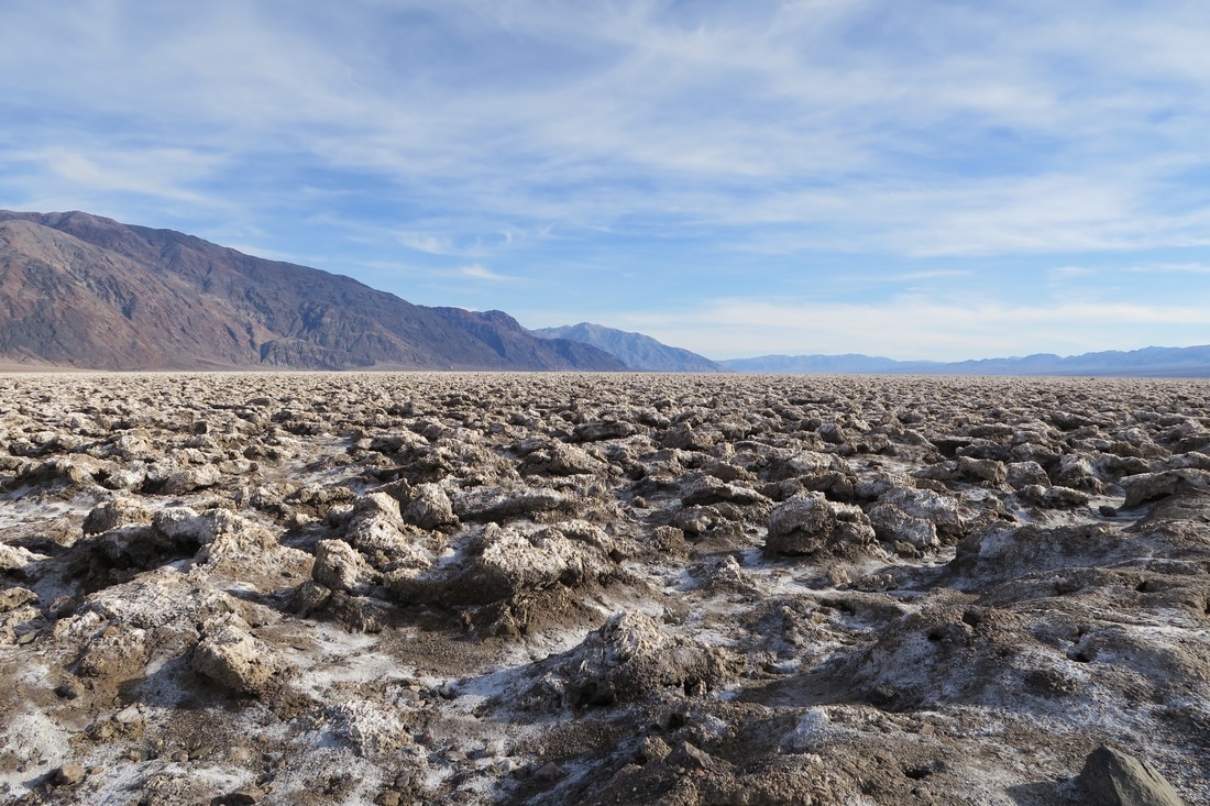
Back on the road, you have to choose a route around the gigantic Naval Air Weapons Station at China Lake. (Per navy.mil: "In total, its two ranges and main site cover more than 1.1 million acres, an area larger than the state of Rhode Island.") Pulling a trailer, the best choice is to head directly north, keeping the Sierra Nevada mountains on your left. There are only two refueling opportunities between Mojave and Furnace Creek in Death Valley – one in the very small town of Olexa, too near to Mojave to be of much use, and one in the Panamint mountains that charges their helpless prey $5 per gallon. This leg is where we really started to get excited by the scenery. The Sierras and the Panamint mountains both rise extremely abruptly out of the desert floor and the valley between them is a very scenic stretch. We wished greatly that we could continue past Lost Pine and on up that valley all the way to the eastern entrance of King’s Canyon and Yosemite, but we turned across the incredible Owens Lake basin and climbed into the highlands on the western edge of Death Valley. It is worth noting that most visitors to Furnace Creek, the natural spring oasis at the center of most human activity in Death Valley’s 3.4 million acres, arrive from the east. It is only a little more than a two hour drive from Las Vegas, as opposed to 5.5 hours from LA, and the most popular car in Death Valley is a neon convertible Mustang with Nevada plates from Avis rental. Descending into the park from the west involves driving over 70 miles of winding mountain and canyon roads, affording views of salt flats and snow-capped peaks limited only by the earth’s curvature. The park's Sunset Campground was cheap and roomy, with amazing mountain views in all directions, great for sunrises and sunsets. There was much more to see than we anticipated. Devil’s Golf Course, a bizarre landscape of jagged, two-foot mineral crust formations in the middle of the valley and well below sea level, is a must-see. The hikes and views, particularly Dante’s View, easily rivaled anything at Big Bend and surpassed most other places we’ve seen for sheer scope and grandeur. Fortunately, most of our top picks were in hindsight within easy driving distance of Furnace Creek, and could be done in a very aggressive weekend or three-day visit. We enjoyed some hikes, including the aptly named Golden Canyon, but can't imagine how they could be done in summer. Surprising no one, the solar panels rocked in Death Valley, the driest place in North America and the hottest place on earth.
Our next major planned stop was Sequoia and Kings Canyon national park. Unfortunately, recent weather and current snow melt narrowed our route options and required us to drive back out of Death Valley to the west, and south all the way down and around the Sierras again before proceeding north to Sequoia. Because this meant another five to six hour journey, we decided to make things interesting by breaking it up and traveling through the Kern Valley and spending a few nights there on Lake Isabella, and visiting the Sequoia National Forest from the south before heading up to Sequoia National Park. This was an inspired choice. We loved Lake Isabella, Kernville, and the southern forest. Interestingly, the locals told us that the lake had been nearly dry (at 5% of capacity) for the last five years, so camping across from glassy mountain reflections, fed and drained by thundering streams, was a very lucky break for us. When we departed the valley to the west, we were treated to what must be one of the great underrated scenic drives in the country. For 45 miles, the road descends along the river valley with the Kern river (and a precipice) on your right and sheer rock face on your left. The view down the valley is of water rushing over giant boulders and rolling green hills spotted with buttes and rock. In several places, there is no guard rail or shoulder, reminiscent of the Gorge du Verdon in France or Italy's Amalfi mountains, only without crazy Europeans blind-passing you on motorcycles. For the most part, it is not so scary as all that, although driving on curving cliffs for such an unusually long distance requires concentration and stamina. Highly recommended for convertible roadster travel and scenic drive aficionados. For small to midsize RV drivers, I’ll classify it as doable. I did not see any bus-length trailers, buses or commercial rigs.
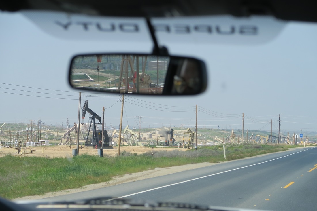
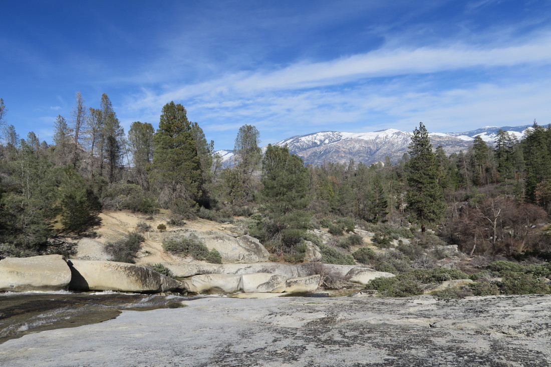 Sequoia National Forest. Much of the remaining ride to Sequoia National Park took us through some frankly ugly and boring industrial farmland. For New Yorkers, orange and lemon trees are novel and cheerful surroundings, but endless, flat plains of orange rows, peppered with stretches of factories, power plants, and plots I can only describe as oil rig farms was a bracing letdown after the Kern Valley. Re-entering the foothills of the Sierra Nevada range from the west brought us to Lake Kaweah and our number one campsite view so far – more on that to come! 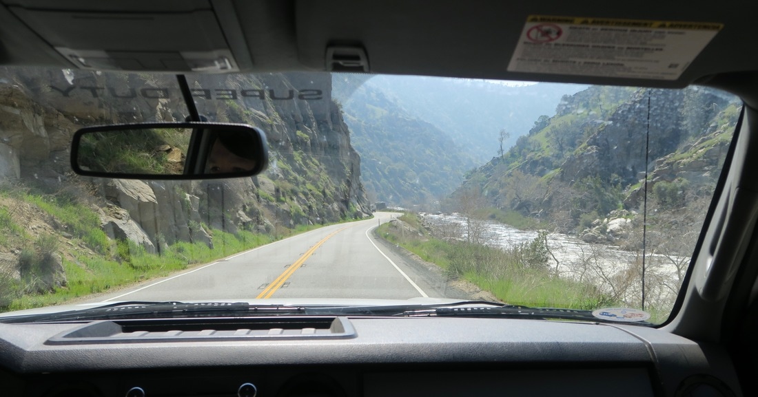 The drive west out of the Kern Valley towards Bakersfield.
AuthorShane |
AuthorsKathryn Tully and Shane Sesta are a married couple, one American and one Brit, who are spending a year traveling across America and writing about their discoveries. Sonny is their rescue cat and fried chicken aficionado. 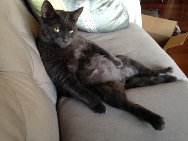
Archives
February 2018
|


 RSS Feed
